Current El Niño might be one of the strongest
 Sahara Green Company
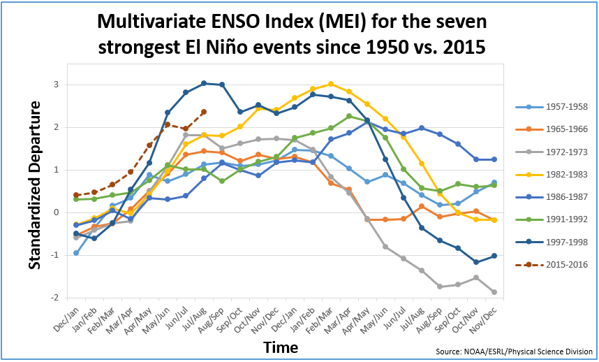
Models indicate that the current El Niño event is likely to be in the top four strongest events since 1950. El Niño is a recurring weather phenomenon that can have both positive and negative impacts on agricultural growing conditions, depending on the region, season, timing and strength.
As illustrated by the Multivariate ENSO Index (MEI) the current El Niño event is among the strongest in the past 65 years (see first chart below). ENSO, which stands for El Niño Southern Oscillation, is a periodic fluctuation in sea surface temperature and the air pressure of the overlying atmosphere across the equatorial Pacific Ocean. The MEI is based on six observed variables: sea-level pressure, sea surface temperature, surface air temperature, zonal surface winds, meridional surface winds, and total cloudiness fraction in the sky.
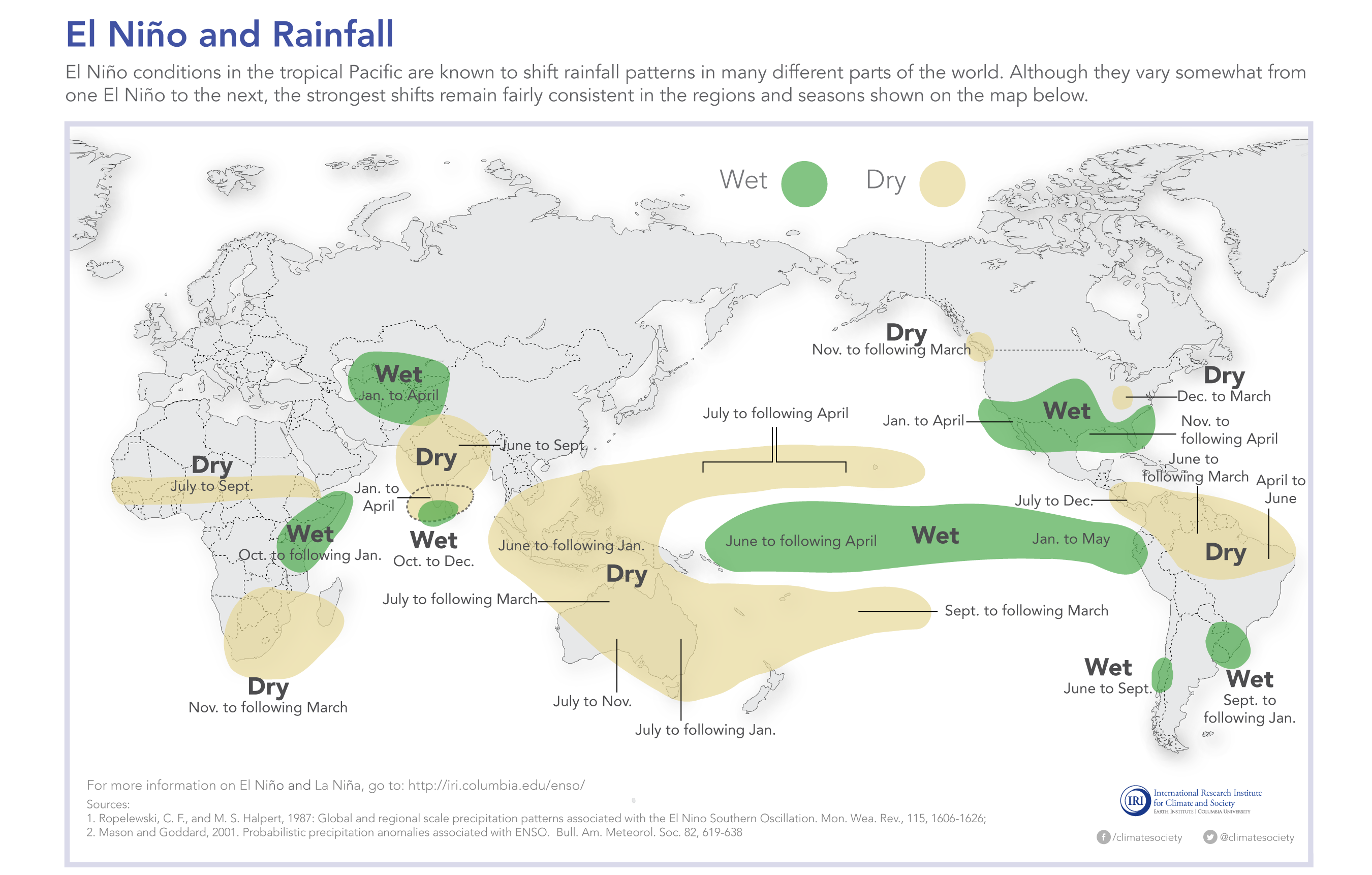
The current event has already affected growing conditions in many regions of the world, particularly in Asia, with drier than average conditions in parts of India, Thailand, Viet Nam and the Philippines, which might now spread to Indonesia. North-central China has experienced below average rainfall, impacting spring and summer crops, whereas parts of southern China have experienced much wetter than average conditions.
In Australia, El Niño is generally associated with reduced precipitation in the east and warmer temperatures in the south. However, increased sea surface temperatures across the Indian Ocean are likely having a moderating effect, so overall conditions have remained favourable for winter crops, though continued rain in coming weeks will be critical. In southern Africa, El Niño traditionally results in below average rainfall during the main growing season (maize). In South America, it generally results in wetter than normal conditions during summer months (soy and maize season) in southern Brazil and Argentina, and drier than normal conditions in northern Brazil. In North America, most effects are expected during the upcoming winter season, with warmer than average temperatures in Canada and the northern United States, and wetter than average conditions across the southern half of the United States. Over Central Asia, El Niño generally increases chances of above average rainfall and snowfall, providing abundant water for growing crops, but also increasing the probability of spring flooding.
AMIS, together with the GEO Global Agricultural Monitoring Initiative (GEOGLAM), will continue monitoring countries and regions that have shown sensitivity to El Niño in the past.
Further information:
- NOAA El Niño: Research, Forecasts, and Observations
- World Meteorological Organization ENSO update
- Bureau of Meteorology, Australia
- UN Food and Agriculture Organization Report
- International Research Institute for Climate and Society (IRI)
(click image to expand)


